White Pine Hollow - June 28, 2018
Hiking Tip
If you're hiking on a trail you haven't been on before, do your research before you go - but be aware of when the info was shared. And take everyone else's info with a grain of salt. Always head out on a hike knowing it might not be as advertised. Try to plan for a few bumps in the road. You may have to decide whether to go on without fully knowing where you're going or to abort the hike and head back. Be willing to fly by the seat of your pants and have an adventure. Or not.
 |
| The trail goes right through there. Can you see it? We couldn't either. |
Our Story
OHMYHOLYHECK! (Yes, it has to all be written together like that.) This hike was so totally not as advertised. (Okay, reviewed. But, whatever.)
Actually, it was the description on AllTrails that was off, but mostly because the AllTrails map tells you to start from Santaquin Canyon and the description is of the trail from the dirt road off of Nebo Loop (at the top). So, if you read it backwards, its pretty accurate, with some notable exceptions which Robin will get to presently!
We love AllTrails! It's an app/website with many trail descriptions, driving instructions, pictures, maps, and reviews. It's never failed us before. It did this time.
Truth be told, the reviews were kind of old. That should have led to some caution on our side. I also looked it up outside of the app. There were several people who blogged about it. They said it was easy and beautiful. Well, they got that half right. It was beautiful.
As it turns out, everyone who reviewed it only did it one way (top to bottom) or only part of it. We definitely didn't get the whole picture.
It is not a maintained trail! The first two miles or so are in good shape. It's obvious that people do this part regularly. Past that, not so much.
AllTrails listed the hike as moderately difficult and moderately trafficked. Nope. We didn't see one other person. And like I said, it didn't look like anyone had been on the top section in a long time. And moderately difficult?! First, I don't know how 8.8 miles would be considered moderate for a day hike unless it were completely flat. It's not completely flat (or at all flat), and it's not 8.8 miles. It's ten miles round trip (the trailhead signs say 5 miles each way; my watch agreed). Second, the amount of giant felled trees and sections with no actual trail make it much more difficult.
 |
| How far does this say the trail is? 5 miles, right. Multiply that by 2 for an out and back hike. What do you get? Not 8.8 miles, that's for sure! |
A couple of the reviews mentioned deadfall. Apparently this means trees that have fallen down and lie across the trail. One said plenty of deadfall but easy to get around. Nope. That review was about a year ago. I don't know if they only did part of the trail or if a lot of trees have fallen since then. There were many places with fallen trees across the trail. Long enough that it wasn't feasible to go around. Big enough that they were tough to get over. And most of the time they had prickly branches that were tough to get through as you went over. Or they had spots where they used to have branches but someone had broken them off, leaving sharp little branch bits that were hard to get over without getting your pants/butt stuck on. (Yup, I got caught on one. It didn't rip my pants, but it took a chunk out of my hip and gave me a big bruise.)
 |
| That one on the left had little bits of broken branches to navigate as we went over that massive fallen tree. The middle one was bigger than it looks, and we had to navigate through those prickly branches. That third one was way to big/high to go over. We had to take off our backpacks to go under. Also, it had more of those little broken branch bits on the underside of that top log that we had to try not to get caught on. |
There is nothing in the AllTrails reviews about stinging nettle. Luckily, one of the blog posts I read mentioned it. It didn't say there was a LOT of it and that it lined the narrow trail a good deal of the time. Luckily, since it mentioned stinging nettle, I researched what to do if the needles get into your skin. All you have to do is barely touch it or brush up against it to get bitten by it. And it stings! (You're supposed to wash well with soapy water, scrubbing to remove the needles. We didn't have access to running water, so I brought wet wipes. We actually ended up using alcohol wipes from my first aid kit. They worked really well.)
Katy was wearing long hiking pants. I don't have any hiking pants, so I was wearing my workout capris. I wish I'd had long, loose pants like hers (although the stinging nettle did get her through her pants once). I was really having a tough time navigating the nettle. Then my brilliant hiking partner had an idea. I always have a bandana or two with me when I'm hiking. She suggested I tie those around my calves to protect them. Worked like a charm! I was still cautious, because the insides of my legs were still exposed, but I was able to get through more easily and didn't get any more stings on my legs after that. I did get a couple on my hands from swinging them at my sides a bit. If I were to go again, I'd wear long pants and long sleeves and take gloves and a machete. (Oh! How I'd love to see Robin with a machete!) I'm big on leaving nature as it is. I don't pick things and try to stay on established trails. But I would gladly clear the nettle away from the trail.
 |
| Sooo much stinging nettle. |
We got off course once by following a tree flag and cairn. Apparently whoever marked that trail wasn't marking for us. Go figure. Luckily, we had our AllTrails map and checked it before we were too far down the wrong trail. Go left at the fork that isn't marked.
 |
| Our AllTrails map. We're the blue dot. The red line is the trail. See how we're on the trail on the left? That's good. See how we're past the end of the trail on the right? That's because the trail on the map ends in the middle of nowhere! We were on our own after that. Eek! |
The trail goes across the stream and back many times. I read that the water is really heavy and deep earlier in the year. It was low and slow when we went. It was cold on our way up (we hit the trail at 6:00 am, and most of it was shaded by the mountain until the sun was up a ways). Since it was cold, we really wanted to stay out of the water. There was one pretty good log bridge early on. There were a couple smaller, not great attempts at log bridges further up. But there were a lot of places you just had to rock hop your way over. A hiking stick was really good to help stabilize yourself for this.
 |
| That pile of logs on the left looks like a good bridge. Yeah, if you had a hiking stick to keep yourself stable. Several of those logs rolled when you stepped on them. The middle picture is what most of the 20 or 30 water crossings looked like (just a guess, but there were a lot). On the way back we were so hot we just walked right through the water. That was nice. |
And there's a long chunk (maybe a hundred yards) that the trail goes right up through the stream bed. You have to rock hop the whole way, although they are bigger, more stable rocks.
This was my favorite thing about the trail. I LOVE water and going in and out of the stream is so fun! Robin liked it, too. I have proof:
 |
| What the heck?! Who said you could post pics, Katy? Anyway, this is the long section of rock hopping our way up the stream bed. It was super fun on the way up. On the way back, I just wanted to be done! |
There's a muddy, marshy spot about 2 1/2 miles up. This is where a lot of people turn around and where Katy said she'd tell people to turn around. You'd get a nice, pretty hike going that far. It would be a good workout. And I'd rate that distance and those obstacles as moderate.
This is also a spot with a big beaver dam! So amazing to see the work of those industrious critters. Not far from here (maybe a 1/4 mile), the stream dries up. No more water! :( AND that's where the trail starts to climb and climb and climb! Almost all that elevation gain is in the second half of the hike. And did I mention that the water feature disappeared? No me gusto.
 |
| It's a little more clear here than it was when we were actually there. The trail goes straight through there, over another big log, to where Katy is sitting. This was one of those times we just had to make our way to higher ground and see if we could find the trail below us. We did. Because we're cool like that. |
 |
| See how there's no trail? |
I would have been lost or had to keep the map in front of me the whole time, if it weren't for Katy. Katy spotted a trail marker. They are those tall brown ones that the forest service puts up. The first one had been ripped partly off. It said, "AIL." We were like, "Fail? Hail? Mail?" The next one said, "IL." Many jokes ensued. Climbing ever upward through the tall grass to a peak that we surely must crest in the next few steps or the next or the next, it came to me. TRAIL! That's what the signs originally said. I found that comforting. Robin? Not nearly so much. That got us a little further. Then she spotted another one. We followed it. And so on the rest of the way. It was the toughest navigating we've done to date. We're definitely not ready for orienteering.

 |
| See the trail next to the trail marker? Yah, us neither. But PRETTY! |
We took another detour near the end, trying to find our way. You have to go through a fence at the top. Then you go slightly down for maybe an 1/8 of a mile before hitting a dirt road--Mona Pole Road--we think, which connects with the Nebo Loop paved road which you can see when you're up higher.
 |
| Go through this gate. There is nothing that says to go through it or that it's part of the trail. (Our trail map ended before we got this far.) But there weren't any No Trespassing signs, so we went for it. Good choice on our part. |
We were looking for a campground that was mentioned in the AllTrails description. We never did find it. We did find the trailhead sign at the top end. In the middle of a bunch of grass. No visible trail at all.
 |
| This is the upper trailhead. See the trailhead marker? Over there on the right, next to the tree. See the trail? No, you don't. There is no trail. |
This was on the Mona Pole Road. If we'd started at that end, I'm not sure we would have found our way. In fact, on the way up there was so little visible trail that I was worried about whether or not we'd be able to find our way back down. Working together we were able to navigate it. She was able to spot trailmarkers (which I couldn't see until we were right on top of them, I'm guessing because I'm colorblind). I was able to remember and recognize several difficult spots of the trail and which way we turned coming up.
It was close to 3000 feet of elevation gain over the 5 miles up. The trail got a lot steeper in parts near the end. I would never start at the top and plan to come back up that way. Some people park a car at the bottom and just hike from the top to the bottom.
 |
| The trail description had said there was a campground at the top with fresh water and a good place to rest. Not even! We rested and ate our lunch on this log across the street from the upper trailhead sign. We were fairly dead at this point and needed the rest. Maybe we'll go back some time and see if we can find the campground they mentioned. In a car, of course. |
I would call this one hard due to the combination of length, elevation gain, and obstacles. If we'd known that ahead of time, I think we'd have had a better time. Since we were expecting moderate, we were grumpy a good deal of the time (me more so than Katy). She wasn't even happy when I spotted more trail markers! "Don't tell me it's another trail marker! I want the trailhead!!" And we were exhausted when we got to the top!
It was beautiful! I'm glad we did it, because we learned a lot. But it was tough. A different kind of tough than the other hard ones I've done. Everything hurt by the time I got home, especially my hips from going over all those fallen trees (I'm 48 and 5'4"; it would probably be easier for someone younger and taller than me).
It was 40* when we hit the trail and 90* as we were coming down. That's a huge flux in a few hours. It took us 6 hours up and 3 hours 40 minutes down. We were much slower than I imagine more experienced hikers would be. I only had 3 hours of sleep the night before, and I think it was too soon after I hiked Squaw Peak (another hard hike). My body needs more recovery time than it used to in between tough workouts. I don't think I waited long enough between those two hikes. Katy would have made it in much better time without me. I needed to stop several times near the top, as it got steep.
 |
| Katy is more accurately representing how we felt when we were finished. I was just glad to be done! |
Recommendations, should you decide to do this hike - Wear long pants. Bring at least one hiking stick. Bring wet wipes or alcohol wipes in case of stinging nettle. Wear shoes you can get in the water and mud with. Maybe bring a machete. (Machete!) Download a map before you go, to make sure you're actually on the trail.
There's so much more I could say, but this is already way too long. Synopsis: Beautiful hike. Tougher than reviewed. Painful. Glad I did it, because I learned a lot. Only do the first two to two and a half miles unless you're experienced. And a masochist. And just really like saying, I DID THAT! Because I don't know why you'd care after the water dries up and you start going straight up the mountain and the trail ends, etc. Come on. Heh, heh.
I just also wanted to mention the wildflowers. Everywhere! And so delicate and pretty. Also, on the way back when the day was warmer, butterflies! At every stream crossing in the sun. Hundreds. Magical. Lastly, this hike does feature a waterfall! Starting where we did in Santaquin canyon, it's only about a half mile in, so you don't work very hard for it, and it's on the far canyon wall so you're not super close to it, but if you're into waterfalls (and who isn't?!) this hike's got one!
 |
 |
| This is the waterfall. This was taken at 6:00 am, so it's kind of dark. Sorry. |
Trail Info
* Difficulty: 6.5/10, maybe 7. It felt tougher that day since we weren't prepared for all the HUGE deadfall. Without that it would probably have been a 6 or a little lower.
* Popularity: I would say not very. We didn't see anyone. There aren't many reviews on AllTrails. And none of my hiker friends had ever heard of it.
* Take hiking sticks. Wear long pants. You might want a machete.
How to Get There
We started at the lower end (Tinney Flats?). Katy was our navigator, since I was driving. From I-15, take exit 244 for US-6 toward Santaquin. Turn left onto US-6/Main Street, almost immediately turn right onto Highland Dr. After a mile, turn left onto Canyon Rd. This is a really pretty canyon! Go up for six miles. You'll pass Tinney Flats campground on your right. Just past the campground the road turns sharply left. Right there on your right is the trailhead. It is well marked but there is no parking lot. We parked along the road.
More Pretty Pictures
 |
| There were two of these big, beautiful walls alongside the trail. No idea why they're there. |
 |
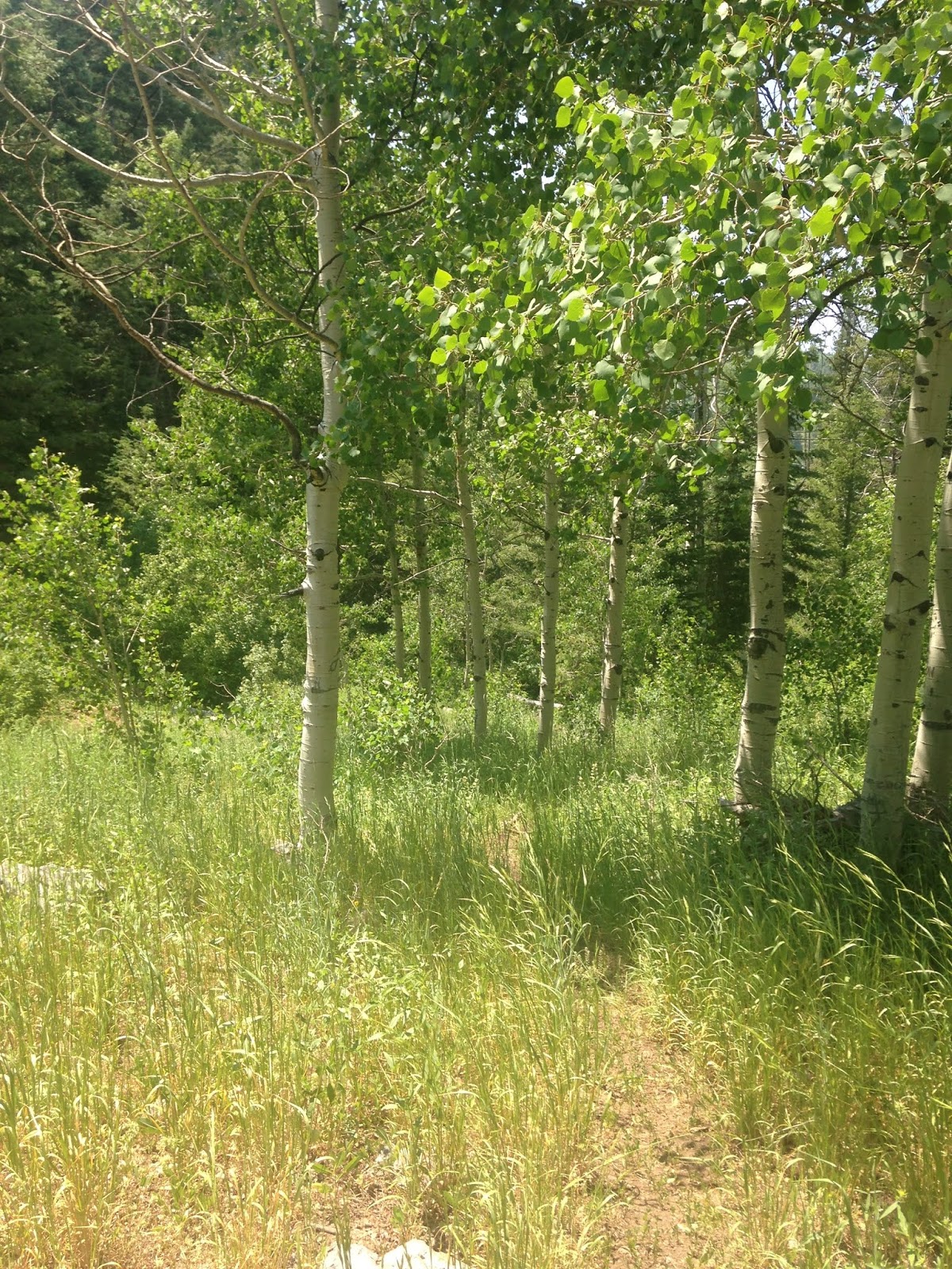
| This is actually a pretty good section of the upper trail. See how you can tell where you're supposed to go? |
 |
| See how pretty those tree trunks are without people's names/initials carved into them? LEAVE THEM THAT WAY! |
 |
 |
 |
 |
| I've seen these on other trails that were marshy. If you know what they are, please tell me. |
 |
 |
| We think this was a cow. There was a huge set of ribs a bit further down the trail. I decided to believe it died a nice, peaceful death from old age - and that there aren't actually wild animals in that area that could kill something that big. Right?! |

Comments
Post a Comment